Winter in Summer? Australia’s Southeast Experiences Coldest February Since 1993 with Dramatic Temperature Drop
Anúncios
Record-Breaking Cold Front Hits Southeast Australia
Southeastern Australia has seen an unprecedented cold front sweep through, delivering the coldest February morning Victoria has experienced since 1993.
Temperatures plummeted to a chilling 5°C. This abrupt drop is nothing short of remarkable for a summer season.
Remarkable Temperature Plunge
Victoria’s record-breaking cold spike came as a surprise to many, signaling one of the most formidable cold fronts in recent history.
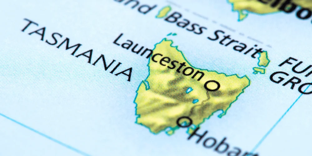
Several states, including Tasmania and southern/eastern New South Wales, recorded temperatures 2 -10°C below the February average, drastically impacting the usual warm summer climate.
Summer Snow and a Cold Breeze
One of the more astonishing aspects of this weather anomaly was the report of summer snow in the Victorian Alps.
The sight of snow during a season typically characterized by heatwaves highlights just how significant this cold front was.
Extensive Impact
This cold surge wasn’t an isolated incident.
A vast pool of cold air originating from the southern ocean spread across the southeastern region, causing widespread impact.
The Bureau of Meteorology noted that both daytime and nighttime temperatures were unusually low, creating an all-encompassing chill that many residents weren’t prepared for.
The combination of cold air and southwesterly winds contributed to a ‘feels-like’ temperature in Melbourne of 8°C, a dramatic contrast from the warmth earlier in the week.
More to Come
While temperatures will soon rise, showing how fickle and variable summer can be, this event serves as a stark reminder of the unpredictable nature of weather patterns.
As southeastern Australia transitions from summer to autumn, residents are encouraged to stay alert and be prepared for these sudden fluctuations.
Understanding the Weather Phenomenon
Unusual weather patterns have recently tossed southeastern Australia into a chilly spell curiously out of season.
The driving force behind this anomaly is a robust pool of cold air journeying from the southern ocean.
When this cold air mass reached the southeastern part of the continent, it brought significant shifts in the weather.
The Source of the Cold Air
The key player in this weather drama is the cold air originating from the southern ocean.
This air mass, laden with chill, made its way upward, pushing through states like Victoria, Tasmania, and southern/eastern New South Wales.
The interaction of this cold air with the typically warmer weather of February has created this rare cold snap.
Widespread Impact
The cold front did not impact just the temperature readings but had a widespread influence across multiple states.
Tasmania, Victoria, and southern and eastern New South Wales all experienced temperatures dipping well below the February norm.
It wasn’t just the daytime mercury that took a hit; nighttime temperatures also felt the effect of this persistent cold front, keeping the region in an unusual cold grip.
Temperature Drops: Day and Night
| Situazione | Descrizione |
|---|---|
| 🌡️ Temperature diurne | Melbourne ha registrato una temperatura percepita di soli 8°C a causa dei venti freddi da sud-ovest. |
| 🌙 Temperature notturne | Canberra è scesa a 3,2°C, mentre i sobborghi di Sydney hanno sperimentato un notevole raffreddamento. |
| ❄️ Avvisi di gelo | Emessi avvisi di gelo nelle aree rurali, con il rischio di danni ai raccolti agricoli. |
| 🚆 Impatti sui trasporti | Ritardi nei trasporti pubblici e strade ghiacciate hanno richiesto interventi straordinari dei comuni locali. |
| 📉 Previsioni a lungo termine | Si prevede che le temperature inferiori alla media continueranno per diversi giorni, richiedendo adattabilità da parte dei residenti. |
Impact on Major Australian Cities
Melbourne’s Temperature Rollercoaster
Melbourne, known for its unpredictable weather, definitely lived up to its reputation during this rare cold front.
Over the weekend, the city experienced a ‘feels-like’ temperature of 8°C.
Residents who ventured outside felt the cold snap sharply, a stark contrast to the warmer days earlier in the week.
According to Bureau of Meteorology senior meteorologist Jonathan How, Melbourne recorded its coldest February morning since 1993, with temperatures dropping to 9.9°C on Sunday morning.
The sharp temperature drop was triggered by a cold southwesterly wind, which swept through Victoria, bringing summer snow to the Victorian Alps.
Canberra’s Notable Temperature Drop
Canberra, the capital city of Australia, also felt the chill.
On Sunday morning, temperatures plummeted to just 3.2°C, startling residents accustomed to milder summer weather.
This unseasonable cold caught many by surprise, underlining the variability and unpredictability of weather patterns in the region.
The cold air mass extended its reach into Canberra, leaving an indelible mark on the city’s February temperature records.
Sydney’s Cooling Suburbs
While Sydney’s central areas experienced milder cooling, its suburbs, especially Campbelltown, felt a significant temperature drop.
Over the weekend, temperatures dipped to 10.5°C, bringing a tangible chill that residents are not typically prepared for in February.
The broader impact of the cold front was evident as the usually warm summer days were replaced by a much cooler atmosphere.
Hobart’s Weekend Shift
Hobart, Tasmania’s capital, experienced notable temperature changes over the weekend.
The cold front’s impact was widespread, affecting both daytime and nighttime temperatures.
The residents of Hobart felt the shift acutely, as the temperature variations became more pronounced.
The city’s weather patterns showed significant deviation from the February norms, emphasizing the cold front’s extensive reach.
Adapting to Weather Fluctuations
The temperature fluctuations witnessed in Melbourne, Canberra, Sydney, and Hobart highlight the need for adaptability in the face of changing weather conditions.
These cities experienced a dramatic shift from summer warmth to unseasonably cold temperatures, an unusual event that underlined the volatility of weather patterns.
With experts forecasting a return to warmer temperatures, including a potential rise to 36°C in Melbourne by Saturday, residents are advised to prepare for continued variability.
As the southeastern regions of Australia brace for more weather changes, it’s essential to stay informed and adaptable.
The recent cold front serves as a reminder of the dynamic and often unpredictable nature of the climate in this part of the world.
Looking Ahead: Temperature Fluctuations
The unexpected cold snap that took southeastern Australia by surprise isn’t a sign that summer is over.
In fact, the weather forecast for Melbourne hints at a return to more typical summer temperatures soon.
By Saturday, the city is expected to experience highs of up to 36°C, a stark contrast to the recent chill.
Unpredictable Temperature Swings
Residents of Melbourne, along with other areas in Victoria, Tasmania, and southern New South Wales, should brace themselves for ongoing temperature fluctuations.
The recent low temperature anomalies are giving way to warmer weather, but it’s clear we’re on a meteorological rollercoaster.
The Bureau of Meteorology’s senior meteorologist, Jonathan How, emphasized the unpredictability of this period, stating that Melbourne’s temperatures “will go up and down” as summer transitions into autumn.
Preparing for the Rollercoaster
Given these swings, residents are advised to be prepared for quick changes in the weather.
Mr. How noted that the shift from cold to warm can be quite “dramatic.”
For those in Melbourne, it might be wise to not pack away the puffer jackets just yet. Keep an eye on the weather reports, as this season seems determined to keep everyone on their toes.
Summer’s Not Over Yet
Despite the cold spell, summer still has some warmth left to deliver.
The forecast suggests more hot days are in the pipeline before autumn sets in definitively.
This continuation of warm weather offers a brief respite before the cooler months take hold.
It’s an excellent reminder of the inherent variability of Australia’s climate, especially as one season gives way to the next.
The clear message is one of adaptability.
Southeastern Australians should be ready for both chillier and warmer days ahead, reflecting the dynamic and unpredictable nature of the weather patterns.
Transitioning from one extreme to another is something Australians have learned to handle, especially with the kind of climate variability on display this February.
As we move forward, understanding and preparing for these shifts will be key to staying comfortable and safe.